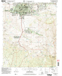
2004 Map of Payson South
USGS Topo · Published 2006About this map
The mountain town of Payson serves as the focal point for this survey of the northern Mogollon Rim country, where the residential expansion of Oxbow Estates meets the vast reaches of the Tonto National Forest. Local civic life is anchored by landmarks like the Julia Randall Sch and the Rodeo Grounds, while the Payson Cem and Mountain Meadows Memorial Gardens provide essential genealogical data points.
Find a feature on this map
74 named features on this map. Tap any name to fly to it.
Don’t see what you’re looking for? This feature index may not catch every label — zoom into the map to look around manually.
Map Details
Editions of this 2004 Payson South Map
This is the sole edition of this map. No revisions or reprints were ever made.
Other maps of this area

1887 · Verde
USGS Topo · 1:250,000

1892 · Verde
USGS Topo · 1:250,000

1934 · Pine
USGS Topo · 1:62,500

1934 · Promontory Butte
USGS Topo · 1:62,500

1936 · Payson
USGS Topo · 1:48,000

1937 · Diamond Butte
USGS Topo · 1:48,000

1939 · Promontory Butte
USGS Topo · 1:62,500

1940 · Pine
USGS Topo · 1:62,500

1942 · Payson
USGS Topo · 1:62,500

1943 · Diamond Butte
USGS Topo · 1:62,500