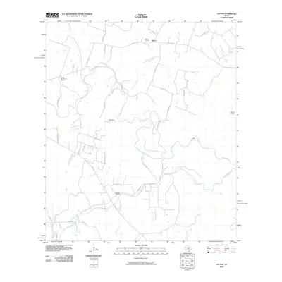
2010 Map of Payton
USGS Topo · Published 2010About this map
The Blanco River and Little Blanco River dominate this landscape in Blanco County, carving deep through the limestone terrain of the Texas Hill Country. The settlement of Payton sits near the northern edge of the sheet, anchored by the Payton Cemetery and connected by historic routes like Payton Colony Rd. This survey reflects the region's ranching heritage and modern rural development, where large landholdings are accessed by named lanes such as Chicken Dinner Rd and White Springs Ranch Rd. Notable topographic features like The Narrows and The Cove illustrate the river's dramatic course, while the Pippen-York Ranch Airport indicates the integration of private aviation into these expansive ranch properties. The transition from broad valleys at Greens Hollow to more confined terrain at Cistern Hollow highlights the varied relief found between the two primary river systems.
Find a feature on this map
47 named features on this map. Tap any name to fly to it.
Don’t see what you’re looking for? This feature index may not catch every label — zoom into the map to look around manually.
Map Details
Editions of this 2010 Payton Map
This is the sole edition of this map. No revisions or reprints were ever made.
Other maps of this area

1887 · Blanco
USGS Topo · 1:125,000

1894 · Blanco
USGS Topo · 1:125,000

1920 · Smithsons Valley
USGS Topo · 1:62,500

1925 · Smithson Valley No. 1
USGS Topo · 1:48,000

1927 · Smithson Valley
USGS Topo · 1:62,500

1929 · Hunter
USGS Topo · 1:62,500

1929 · Smithson Valley
USGS Topo · 1:62,500

1940 · Smithson Valley
USGS Topo · 1:62,500

1954 · Llano
USGS Topo · 1:250,000

1954 · San Antonio
USGS Topo · 1:250,000