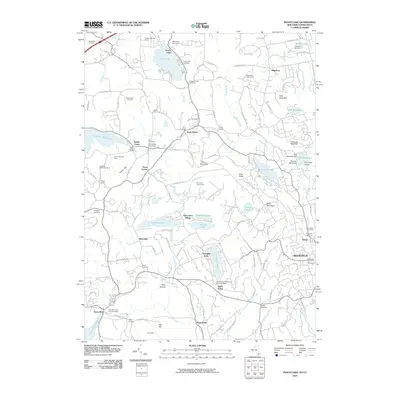
2010 Map of Peach Lake
USGS Topo · Published 2010About this map
Titicus Reservoir and Cross River Reservoir dominate the hydrology of this borderland area, where the Connecticut and New York state lines intersect. The map illustrates a landscape of suburban density and historic rural pockets, featuring a high concentration of family and community burial grounds such as Drewclift Cemetery, Quaker Church Cemetery, and Keeler Cemetery. Small population centers like Salem Center, South Salem, and Ridgefield show established residential patterns around the local lakes. Numerous named corners, including Crane Corner and Yerkes Corner, suggest older crossroads identities that persisted even as the region developed. The presence of specialized sites like the North Salem Vineyard and Ridgefield Golf Course reflects the 21st-century character of these well-established communities in the Titicus River valley.
Find a feature on this map
98 named features on this map. Tap any name to fly to it.
Don’t see what you’re looking for? This feature index may not catch every label — zoom into the map to look around manually.
Map Details
Editions of this 2010 Peach Lake Map
This is the sole edition of this map. No revisions or reprints were ever made.
Other maps of this area

1892 · Stamford
USGS Topo · 1:62,500

1892 · Danbury
USGS Topo · 1:62,500

1892 · Norwalk
USGS Topo · 1:62,500

1892 · Carmel
USGS Topo · 1:62,500

1893 · Carmel
USGS Topo · 1:62,500

1893 · Stamford
USGS Topo · 1:62,500

1893 · Norwalk
USGS Topo · 1:62,500

1894 · Carmel
USGS Topo · 1:62,500

1899 · Stamford
USGS Topo · 1:62,500

1915 · Danbury
USGS Topo · 1:62,500