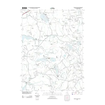
2013 Map of Peach Lake
USGS Topo · Published 2013About this map
North Salem and its surrounding hamlets define this landscape along the New York and Connecticut border, where historic land divisions meet a chain of glacial lakes. The area is marked by numerous family-named crossroads such as Fields' Corners, Rundle's Corners, and Lobdell Corner, reflecting a long-established agricultural and residential pattern. High ground at Titicus Mountain and Scott Ridge overlooks a series of significant water bodies, including Peach Lake and the Titicus Reservoir. Genealogists will find a high density of burial grounds documented here, from the Quaker Church Cem near Dingle to the S Salem Presbyterian Church Cem in South Salem. The map also captures specialized land uses like the North Salem Vineyard and Chase Meadows Farm, alongside recreational landmarks such as Mamanasco Lake and Lake Waccabuc.
Find a feature on this map
295 named features on this map. Tap any name to fly to it.
Don’t see what you’re looking for? This feature index may not catch every label — zoom into the map to look around manually.
Map Details
Editions of this 2013 Peach Lake Map
This is the sole edition of this map. No revisions or reprints were ever made.
Other maps of this area

1892 · Stamford
USGS Topo · 1:62,500

1892 · Danbury
USGS Topo · 1:62,500

1892 · Norwalk
USGS Topo · 1:62,500

1892 · Carmel
USGS Topo · 1:62,500

1893 · Carmel
USGS Topo · 1:62,500

1893 · Stamford
USGS Topo · 1:62,500

1893 · Norwalk
USGS Topo · 1:62,500

1894 · Carmel
USGS Topo · 1:62,500

1899 · Stamford
USGS Topo · 1:62,500

1915 · Danbury
USGS Topo · 1:62,500