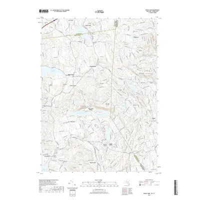
2019 Map of Peach Lake
USGS Topo · Published 2019About this map
Peach Lake and the surrounding borderlands of New York and Connecticut are defined by a complex network of reservoirs and small hamlets. The landscape is punctuated by numerous family and community burial grounds, such as the Colonel Enoch Avery Cem and Mead Cem, reflecting deep ancestral ties to the townships of South Salem and North Salem. Water management for the region is evident in the presence of the Titicus Reservoir and Cross River Reservoir, which submerged earlier valley terrain to support the growing metropolitan demand. Smaller residential pockets like Twin Lakes Village and Boutonville sit among prominent elevations including East Long Pond Mtn and Ned Mtn. The South Salem Presbyterian Church serves as a central landmark in a region where the colonial-era road network has evolved into modern routes like NY 121 and NY 116, bridging the divide between Westchester and Fairfield counties.
Find a feature on this map
61 named features on this map. Tap any name to fly to it.
Don’t see what you’re looking for? This feature index may not catch every label — zoom into the map to look around manually.
Map Details
Editions of this 2019 Peach Lake Map
This is the sole edition of this map. No revisions or reprints were ever made.
Other maps of this area

1892 · Stamford
USGS Topo · 1:62,500

1892 · Danbury
USGS Topo · 1:62,500

1892 · Norwalk
USGS Topo · 1:62,500

1892 · Carmel
USGS Topo · 1:62,500

1893 · Carmel
USGS Topo · 1:62,500

1893 · Stamford
USGS Topo · 1:62,500

1893 · Norwalk
USGS Topo · 1:62,500

1894 · Carmel
USGS Topo · 1:62,500

1899 · Stamford
USGS Topo · 1:62,500

1915 · Danbury
USGS Topo · 1:62,500