
Loading...
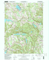
Loading map...2023 Map of Peach Lake
USGS Topo · Published 2023About this map
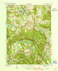
South Salem and North Salem anchor this landscape along the New York and Connecticut border, where a dense network of colonial-era roads like Old Post Rd and Boutonville Rd connect long-standing hamlets. The map is a significant resource for genealogical research, featuring numerous burial grounds such as the South Salem Presbyterian Church Cem, Peach Pond Friends Cem, and the Keeler Burying Ground Cem.
Find a feature on this map
175 named features on this map. Tap any name to fly to it.
Don’t see what you’re looking for? This feature index may not catch every label — zoom into the map to look around manually.
Map Details
Date Portrayed2023
Date Published2023
PublisherU.S. Geological Survey
Map TypeTopographic
Scale1:24000
Physical Dimensions24 x 29 inches
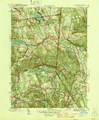
Editions of this 2023 Peach Lake Map
This is the sole edition of this map. No revisions or reprints were ever made.
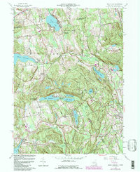
Historical Maps of Yurt Village Through Time
5 maps found
Featured Locations
Source Details
SourceU.S. Geological Survey
CopyrightPublic Domain