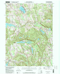
1998 Map of Peach Lake
USGS Topo · Published 2001About this map
The Titicus Reservoir and the glacial lakes of Westchester County and Fairfield County dominate this landscape at the close of the twentieth century. The topography is defined by the steep north-south ridges of West Mountain and Starr Ridge, which have historically channeled settlement into the valleys. Communities like North Salem, South Salem, and Ridgebury are depicted with their established networks of local landmarks, including the Peach Lake Meetinghouse and St Johns Ch.
Find a feature on this map
58 named features on this map. Tap any name to fly to it.
Don’t see what you’re looking for? This feature index may not catch every label — zoom into the map to look around manually.
Map Details
Editions of this 1998 Peach Lake Map
This is the sole edition of this map. No revisions or reprints were ever made.
Other maps of this area

1892 · Stamford
USGS Topo · 1:62,500

1892 · Danbury
USGS Topo · 1:62,500

1892 · Norwalk
USGS Topo · 1:62,500

1892 · Carmel
USGS Topo · 1:62,500

1893 · Carmel
USGS Topo · 1:62,500

1893 · Stamford
USGS Topo · 1:62,500

1893 · Norwalk
USGS Topo · 1:62,500

1894 · Carmel
USGS Topo · 1:62,500

1899 · Stamford
USGS Topo · 1:62,500

1915 · Danbury
USGS Topo · 1:62,500