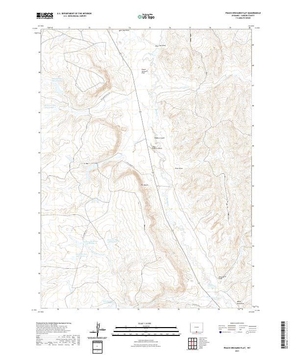
2021 Map of Peach Orchard Flat
USGS Topo · Published 2021About this map
Peach Orchard Flat sits at the center of this high-plains landscape in Carbon County, where the terrain is defined by a network of seasonal drainages and named gulches. The modern topography reveals a complex system of water management infrastructure, including Detention Reservoir 1492 Number 2 and several other numbered detention dams like Detention Dam 1592 Number 1, designed to control runoff through the arid basins. Landforms such as The Bluffs and Robbers Gulch punctuate the landscape, suggesting a history of travel and concealment along the old paths that cross this region.
Find a feature on this map
27 named features on this map. Tap any name to fly to it.
Don’t see what you’re looking for? This feature index may not catch every label — zoom into the map to look around manually.
Map Details
Editions of this 2021 Peach Orchard Flat Map
This is the sole edition of this map. No revisions or reprints were ever made.
Other maps of this area

1954 · Rawlins
USGS Topo · 1:250,000

1957 · Baggs
USGS Topo · 1:62,500

1957 · Doty Mountain
USGS Topo · 1:62,500

1958 · Rawlins
USGS Topo · 1:250,000

1962 · Rawlins
USGS Topo · 1:250,000

1967 · Rawlins
USGS Topo · 1:250,000

1970 · Mexican Flats
USGS Topo · 1:24,000
1970 · Flat Top Mountain
USGS Topo · 1:24,000
1970 · Poison Basin
USGS Topo · 1:24,000
1975 · Baggs NW
USGS Topo · 1:24,000