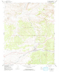
1967 Map of Peach Springs
USGS Topo · Published 1991About this map
Hualapai Indian Reservation lands dominate this mid-century topographic record, centering on the community of Peach Springs. The landscape is defined by the convergence of deep drainage systems, including Peach Springs Canyon and Truxton Canyon, which channel the region's scarce water toward the northwest. The presence of the Atchison Topeka and Santa Fe railroad line running through Truxton Canyon underscores the vital transportation corridor that has long connected this part of northern Arizona to the broader western rail network.
Find a feature on this map
25 named features on this map. Tap any name to fly to it.
Don’t see what you’re looking for? This feature index may not catch every label — zoom into the map to look around manually.
Map Details
Editions of this 1967 Peach Springs Map
2 editions found
Other maps of this area

1886 · Diamond Creek
USGS Topo · 1:250,000

1892 · Diamond Creek
USGS Topo · 1:250,000

1948 · Williams
USGS Topo · 1:250,000

1954 · Williams
USGS Topo · 1:250,000

1956 · Williams
USGS Topo · 1:250,000

1960 · Williams
USGS Topo · 1:250,000

1961 · Williams
USGS Topo · 1:250,000
1967 · Milkweed Canyon SE
USGS Topo · 1:24,000

1967 · Peach Springs
USGS Topo · 1:24,000
1967 · Peach Springs Canyon
USGS Topo · 1:24,000