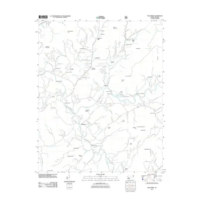
2011 Map of Peachtree
USGS Topo · Published 2011About this map
The Hiwassee River and its tributary Peachtree Creek define the geography of this western North Carolina landscape, where early industry and agriculture followed the fertile bottomlands. Local heritage is preserved in sites like Arrwood Mill and Jones Mill, while the spiritual and familial history of the area is anchored by Ferguson Cemetery, Mc Guire Cemetery, and Wells Cemetery. The settlement at Brasstown serves as a focal point in the southern portion of the map, near where Creamery Rd and Folk School Rd hint at the community's agricultural and educational traditions. To the north, the terrain rises toward Mumblehead Top and Will Scott Mountain, framing the narrow coves such as Henson Cove and Fain Cove that provided secluded homestead sites. The transition from free-flowing water to managed resources is visible at Mission Dam and Carrol Lake Dam, marking the intersection of the natural river system with modern infrastructure.
Find a feature on this map
196 named features on this map. Tap any name to fly to it.
Don’t see what you’re looking for? This feature index may not catch every label — zoom into the map to look around manually.
Map Details
Editions of this 2011 Peachtree Map
This is the sole edition of this map. No revisions or reprints were ever made.
Other maps of this area

1886 · Dahlonega
USGS Topo · 1:125,000

1888 · Ellijay
USGS Topo · 1:125,000

1892 · Dahlonega
USGS Topo · 1:125,000

1892 · Ellijay
USGS Topo · 1:125,000

1893 · Murphy
USGS Topo · 1:125,000

1896 · Dahlonega
USGS Topo · 1:125,000

1898 · Ellijay
USGS Topo · 1:125,000

1903 · Dahlonega
USGS Topo · 1:125,000

1911 · Ellijay
USGS Topo · 1:125,000

1914 · Murphy
USGS Topo · 1:125,000