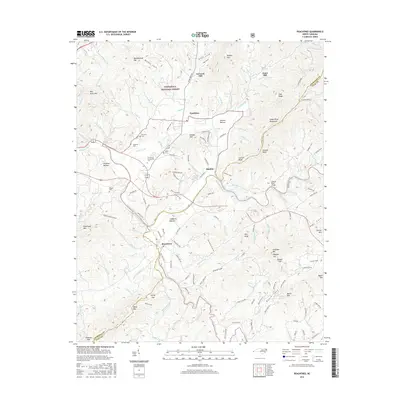
2016 Map of Peachtree
USGS Topo · Published 2016About this map
Brasstown and Peachtree anchor this detailed study of the southwestern North Carolina mountains where the Hiwassee River and Valley River converge. The landscape is defined by its deep coves and bottomlands, such as Harshaw Bottom and Suddawig Bottom, which historically provided the primary arable land for local families. This 2016 survey documents a network of rural routes and family landmarks, including Ferguson Cem and Mc Guire Cem, alongside mid-century infrastructure like the Shallow Ford Bridge. Educational growth is represented by the Tri-County Community Coll, while the periphery remains under the canopy of the Nantahala National Forest. The map traces numerous tributaries like Peachtree Cr and Slow Cr that once powered local industry, as evidenced by the namesake sites of Arrwood Mill and Jones Mill.
Find a feature on this map
139 named features on this map. Tap any name to fly to it.
Don’t see what you’re looking for? This feature index may not catch every label — zoom into the map to look around manually.
Map Details
Editions of this 2016 Peachtree Map
This is the sole edition of this map. No revisions or reprints were ever made.
Other maps of this area

1886 · Dahlonega
USGS Topo · 1:125,000

1888 · Ellijay
USGS Topo · 1:125,000

1892 · Dahlonega
USGS Topo · 1:125,000

1892 · Ellijay
USGS Topo · 1:125,000

1893 · Murphy
USGS Topo · 1:125,000

1896 · Dahlonega
USGS Topo · 1:125,000

1898 · Ellijay
USGS Topo · 1:125,000

1903 · Dahlonega
USGS Topo · 1:125,000

1911 · Ellijay
USGS Topo · 1:125,000

1914 · Murphy
USGS Topo · 1:125,000