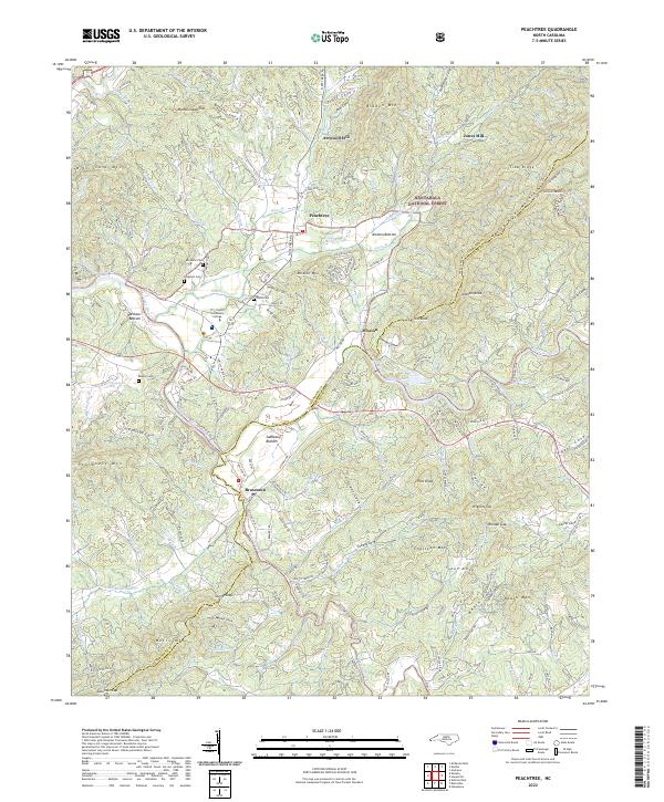
2022 Map of Peachtree
USGS Topo · Published 2022About this map
Peachtree and Brasstown anchor this mountain landscape at the confluence of the Hiwassee River and Brasstown Creek. The settlement pattern follows the fertile bottomlands, where names like Harshaw Bottom, Ammon Bottom, and Suddawig Bottom reflect the agricultural heritage of the valley floors beneath the Valley River Mountains. This contemporary record shows a blend of longstanding community institutions and private family history, with the Tri-County Community College campus situated near several established burial grounds including Ferguson Cem, Wells Cem, and Mc Guire Cem. The presence of Arrwood Mill and Jones Mill along the northern creeks indicates a legacy of water-powered industry that once supported these isolated coves. To the east, the boundary of the Nantahala National Forest marks the transition from residential valley life to the steep, wooded slopes of Mission Mtn and Chasteen Mtn.
Find a feature on this map
173 named features on this map. Tap any name to fly to it.
Don’t see what you’re looking for? This feature index may not catch every label — zoom into the map to look around manually.
Map Details
Editions of this 2022 Peachtree Map
This is the sole edition of this map. No revisions or reprints were ever made.
Other maps of this area

1886 · Dahlonega
USGS Topo · 1:125,000

1888 · Ellijay
USGS Topo · 1:125,000

1892 · Dahlonega
USGS Topo · 1:125,000

1892 · Ellijay
USGS Topo · 1:125,000

1893 · Murphy
USGS Topo · 1:125,000

1896 · Dahlonega
USGS Topo · 1:125,000

1898 · Ellijay
USGS Topo · 1:125,000

1903 · Dahlonega
USGS Topo · 1:125,000

1911 · Ellijay
USGS Topo · 1:125,000

1914 · Murphy
USGS Topo · 1:125,000