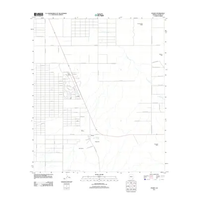
2011 Map of Pearce
USGS Topo · Published 2011About this map
Pearce occupies a high-desert landscape in Cochise County, defined by its rigid residential street grid and scattered mining-era remnants. The settlement is centered around the Pearce Post Office, while the surrounding terrain is dominated by prominent elevations such as Pearce Hill and Sixmile Hill. To the north and east, the natural landscape is shaped by the drainage of Turkey Creek as it winds past the Sulphur Hills and the distinct peaks of Three Sisters Buttes. Local history is anchored at the Pearce Cemetery, located just west of the main town center. The road network, including names like N Arabian Ln and E Curry Farm Rd, suggests a shift toward rural residential and agricultural land use in the valleys between these rocky outcrops. This survey captures the layout of the community and its relationship to the high-desert landmarks of Township Butte and the surrounding basin.
Find a feature on this map
65 named features on this map. Tap any name to fly to it.
Don’t see what you’re looking for? This feature index may not catch every label — zoom into the map to look around manually.
Map Details
Editions of this 2011 Pearce Map
This is the sole edition of this map. No revisions or reprints were ever made.
Other maps of this area

1916 · Pearce
USGS Topo · 1:125,000

1922 · Willcox
USGS Topo · 1:125,000

1926 · Light
USGS Topo · 1:62,500

1926 · Courtland
USGS Topo · 1:62,500

1943 · Dos Cabezas
USGS Topo · 1:62,500

1943 · Cochise
USGS Topo · 1:62,500

1954 · Silver City
USGS Topo · 1:250,000

1955 · Douglas
USGS Topo · 1:250,000

1957 · Dos Cabezas
USGS Topo · 1:62,500

1958 · Silver City
USGS Topo · 1:250,000