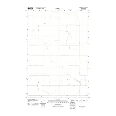
2011 Map of Pearl Butte
USGS Topo · Published 2011About this map
Saint Peters Cemetery stands as a quiet focal point in this sparsely settled landscape of southern North Dakota. The terrain is characterized by the prominent elevation of Pearl Butte and the winding course of Duck Creek, which bisects the grid of section roads from northwest to southeast. This 2011 survey by the U.S. Geological Survey illustrates a modern prairie landscape defined more by its surveyed boundaries and agricultural access than by dense township centers. A significant water management feature, the Duck Creek Dam, is visible in the eastern half of the quadrangle, serving the surrounding rural area. The rigid network of numerical avenues and streets, including 9th Ave NE and 12th St NE, highlights the orderly development of the northern Great Plains, where long stretches of road connect isolated points of interest like the local Dumpground Rd.
Find a feature on this map
19 named features on this map. Tap any name to fly to it.
Don’t see what you’re looking for? This feature index may not catch every label — zoom into the map to look around manually.
Map Details
Editions of this 2011 Pearl Butte Map
This is the sole edition of this map. No revisions or reprints were ever made.
Other maps of this area

1953 · Dickinson
USGS Topo · 1:250,000

1954 · Lemmon
USGS Topo · 1:250,000

1957 · Dickinson
USGS Topo · 1:250,000

1957 · Lemmon
USGS Topo · 1:250,000

1974 · Pearl Butte NW
USGS Topo · 1:24,000

1974 · Long Butte
USGS Topo · 1:24,000

1974 · White Butte
USGS Topo · 1:24,000

1974 · Kid Rich Butte
USGS Topo · 1:24,000

1974 · Haynes
USGS Topo · 1:24,000

1980 · Mott
USGS Topo · 1:100,000