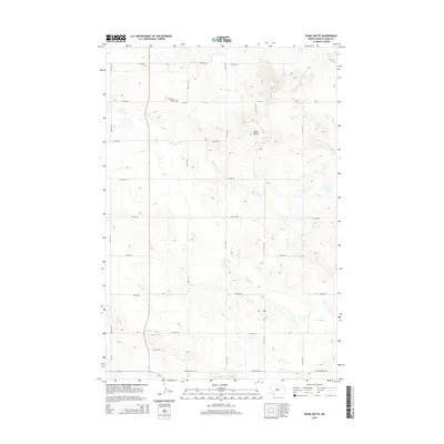
2014 Map of Pearl Butte
USGS Topo · Published 2014About this map
Pearl Butte rises from the landscape of northern Adams County, serving as a prominent topographic landmark in this section of the Great Plains. The map details a strictly organized section-line road network, where routes like 8th Ave Ne and 10th St Ne carve the prairie into a distinct grid typical of North Dakota's agricultural heritage. This structured layout is occasionally broken by the wandering path of Duck Cr, which drains the undulating terrain. A significant site for local history and genealogy is Saint Peters Cem, a quiet burial ground positioned near the intersection of 8th Ave Ne and 10th St Ne. The presence of Dumpground Rd at the southern edge suggests local municipal utility in an area otherwise dedicated to open land and widely spaced rural homesteads.
Find a feature on this map
19 named features on this map. Tap any name to fly to it.
Don’t see what you’re looking for? This feature index may not catch every label — zoom into the map to look around manually.
Map Details
Editions of this 2014 Pearl Butte Map
This is the sole edition of this map. No revisions or reprints were ever made.
Other maps of this area

1953 · Dickinson
USGS Topo · 1:250,000

1954 · Lemmon
USGS Topo · 1:250,000

1957 · Dickinson
USGS Topo · 1:250,000

1957 · Lemmon
USGS Topo · 1:250,000

1974 · Pearl Butte NW
USGS Topo · 1:24,000

1974 · Long Butte
USGS Topo · 1:24,000

1974 · White Butte
USGS Topo · 1:24,000

1974 · Kid Rich Butte
USGS Topo · 1:24,000

1974 · Haynes
USGS Topo · 1:24,000

1980 · Mott
USGS Topo · 1:100,000