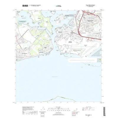
2017 Map of Pearl Harbor
USGS Topo · Published 2017About this map
JBPHH Pearl Harbor-HI and the surrounding military infrastructure anchor this modern view of the southern Oahu coastline. The complex geography of the harbor is defined by the West Loch, Middle Loch, and East Loch, which frame the central Ford Island. The landscape reflects decades of strategic development, from the World War II Valor in the Pacific National Monument to the massive footprint of the Daniel K Inouye International Airport along the Māmala Bay shoreline.
Find a feature on this map
73 named features on this map. Tap any name to fly to it.
Don’t see what you’re looking for? This feature index may not catch every label — zoom into the map to look around manually.
Map Details
Editions of this 2017 Pearl Harbor Map
This is the sole edition of this map. No revisions or reprints were ever made.
Other maps of this area

1953 · Schofield Barracks
USGS Topo · 1:24,000

1953 · Honolulu
USGS Topo · 1:24,000

1953 · Ewa
USGS Topo · 1:24,000

1953 · Puuloa
USGS Topo · 1:24,000

1954 · Oahu
USGS Topo · 1:250,000

1954 · Kaneohe
USGS Topo · 1:24,000

1954 · Waipahu
USGS Topo · 1:24,000

1959 · Kaneohe
USGS Topo · 1:24,000

1959 · Honolulu
USGS Topo · 1:24,000

1959 · Waipahu
USGS Topo · 1:24,000