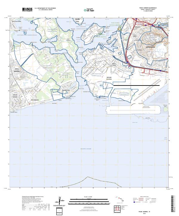
2024 Map of Pearl Harbor
USGS Topo · Published 2024About this map
Pearl Harbor National Memorial anchors this detailed survey of Oahu's southern coast, centered on the complex geography of Pearl Harbor. The map reveals the intricate shoreline of the West Loch, Middle Loch, and East Loch, punctuated by points such as Beckoning Point and Waipi'o Peninsula. This modern landscape is heavily defined by military and transportation infrastructure, dominated by the sprawling Joint Base Pearl Harbor-Hickam and the massive Daniel K Inouye International Airport. Beyond the airfields and naval docks, residential and commercial hubs like Pearl City, Halawa, and Ewa Beach illustrate the dense urban development extending from Honolulu. Conservation efforts are also prominent, notably the Pearl Harbor National Wildlife Refuge, which provides a protected natural contrast to the industrial and military activity surrounding the USS Arizona Memorial.
Find a feature on this map
160 named features on this map. Tap any name to fly to it.
Don’t see what you’re looking for? This feature index may not catch every label — zoom into the map to look around manually.
Map Details
Editions of this 2024 Pearl Harbor Map
This is the sole edition of this map. No revisions or reprints were ever made.
Other maps of this area

1953 · Schofield Barracks
USGS Topo · 1:24,000

1953 · Honolulu
USGS Topo · 1:24,000

1953 · Ewa
USGS Topo · 1:24,000

1953 · Puuloa
USGS Topo · 1:24,000

1954 · Oahu
USGS Topo · 1:250,000

1954 · Kaneohe
USGS Topo · 1:24,000

1954 · Waipahu
USGS Topo · 1:24,000

1959 · Kaneohe
USGS Topo · 1:24,000

1959 · Honolulu
USGS Topo · 1:24,000

1959 · Waipahu
USGS Topo · 1:24,000