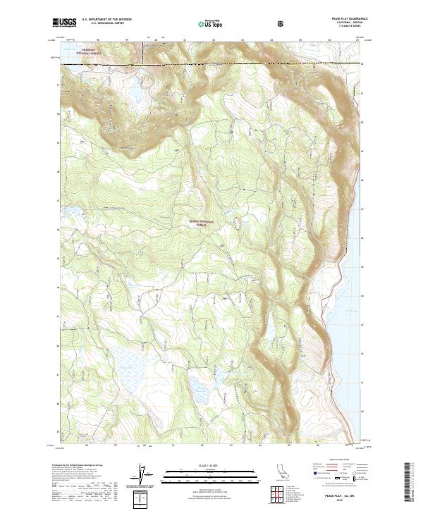
2022 Map of Pease Flat
USGS Topo · Published 2022About this map
Pease Flat and the expansive western shoreline of Goose Lake define this high-altitude borderland between California and Oregon. The landscape is a complex network of hydrological features managed within the Modoc National Forest, including the Enquest Reservoir, Everly Reservoir, and Householder Reservoir. These water management sites, along with unique landmarks like Meteorite Tank and Hole-in-Ground Spring, highlight the essential role of water distribution in this arid timber and rangeland. The presence of Dry Creek Rim provides a significant topographical break in the terrain, which is otherwise navigated by industrial and forest service routes like Weyerhaeuser Road. This 2022 survey documents the contemporary boundaries where the Fremont National Forest meets its southern neighbor at the state line.
Find a feature on this map
32 named features on this map. Tap any name to fly to it.
Don’t see what you’re looking for? This feature index may not catch every label — zoom into the map to look around manually.
Map Details
Editions of this 2022 Pease Flat Map
This is the sole edition of this map. No revisions or reprints were ever made.
Other maps of this area

1886 · Alturas
USGS Topo · 1:250,000

1892 · Alturas
USGS Topo · 1:250,000

1954 · Alturas
USGS Topo · 1:250,000

1955 · Klamath Falls
USGS Topo · 1:250,000

1958 · Alturas
USGS Topo · 1:250,000

1958 · Klamath Falls
USGS Topo · 1:250,000

1962 · Alturas
USGS Topo · 1:250,000

1962 · Willow Ranch
USGS Topo · 1:62,500

1962 · South Mountain
USGS Topo · 1:62,500

1964 · Lakeview SW
USGS Topo · 1:24,000