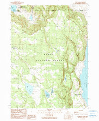
1990 Map of Pease Flat
USGS Topo · Published 1990About this map
The high plateau of the Modoc National Forest meets the western shoreline of Goose Lake along this rugged California-Oregon border region. The landscape is defined by the steep descent from the Rim down into the lake basin, a transition marked by numerous springs and small-scale water management features. Isolated livestock operations including Point Ranch, Cove Ranch, and Everly Ranch are established near the base of the hills, while the X L Ranch Indian Reservation occupies a significant portion of the lower lake flats. The presence of several artificial basins, such as Enquist Reservoir and Householder Reservoir, suggests a landscape engineered to sustain ranching in an area where names like Dry Creek indicate a seasonal water supply. Evidence of early habitation and range management is visible through landmarks like Pease Cabin and the curiously named Meteorite Tank.
Find a feature on this map
24 named features on this map. Tap any name to fly to it.
Don’t see what you’re looking for? This feature index may not catch every label — zoom into the map to look around manually.
Map Details
Editions of this 1990 Pease Flat Map
This is the sole edition of this map. No revisions or reprints were ever made.
Other maps of this area

1886 · Alturas
USGS Topo · 1:250,000

1892 · Alturas
USGS Topo · 1:250,000

1954 · Alturas
USGS Topo · 1:250,000

1955 · Klamath Falls
USGS Topo · 1:250,000

1958 · Alturas
USGS Topo · 1:250,000

1958 · Klamath Falls
USGS Topo · 1:250,000

1962 · Alturas
USGS Topo · 1:250,000

1962 · Willow Ranch
USGS Topo · 1:62,500

1962 · South Mountain
USGS Topo · 1:62,500

1964 · Lakeview SW
USGS Topo · 1:24,000