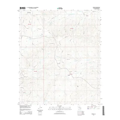
2015 Map of Peason
USGS Topo · Published 2015About this map
Peason and Corleyville anchor this corner of Sabine Parish, where the headwaters of numerous creeks and bayous define the landscape. This 2015 study illustrates a network of rural routes such as Jordan Crossing Rd and Meadow Ln that trace the ridges between drainages. The topography is dominated by the prominent Eagle Hill in the southeast, while the central portion is drained by Kisatchie Bayou. Smaller watercourses like Kib Bayou, Wolf Prong Br, and Middle Cr crisscross the region, suggesting the complex hydrology of these Louisiana pine woods. Local history is etched into the landscape through family-named landmarks and thoroughfares such as George Bell Rd and Berry Hough Rd. In the northeast, the settlement of Coburn sits near the junction of Barron Rd and Middle Cr, illustrating the long-standing pattern of development alongside these vital water sources.
Find a feature on this map
73 named features on this map. Tap any name to fly to it.
Don’t see what you’re looking for? This feature index may not catch every label — zoom into the map to look around manually.
Map Details
Editions of this 2015 Peason Map
This is the sole edition of this map. No revisions or reprints were ever made.
Other maps of this area

1937 · Bellwood
USGS Topo · 1:31,680

1942 · Many
USGS Topo · 1:62,500

1942 · Florien
USGS Topo · 1:62,500

1942 · Kisatchie
USGS Topo · 1:62,500

1943 · Many
USGS Topo · 1:62,500

1943 · Kisatchie
USGS Topo · 1:62,500

1943 · Provencal
USGS Topo · 1:62,500

1944 · Florien
USGS Topo · 1:62,500

1945 · Provencal
USGS Topo · 1:62,500

1953 · Alexandria
USGS Topo · 1:250,000