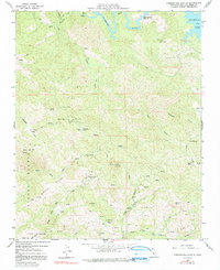
1959 Map of Pebblestone Shut-In
USGS Topo · Published 1991About this map
Mining operations and rugged coastal ridges define this landscape during the late 1950s, a period when the Nacimiento Res was a central feature of northern San Luis Obispo County. The map reveals an intensive history of extraction throughout the Santa Lucia Range, marked by numerous sites such as the Cambria Mine, Keystone Mine, and Almaden Mine. This concentration of mines, alongside several unnamed prospects, underscores the region's geological significance for quicksilver and other minerals.
Find a feature on this map
46 named features on this map. Tap any name to fly to it.
Don’t see what you’re looking for? This feature index may not catch every label — zoom into the map to look around manually.
Map Details
Editions of this 1959 Pebblestone Shut-In Map
4 editions found
Other maps of this area

1919 · Bryson
USGS Topo · 1:62,500

1919 · Bradley
USGS Topo · 1:62,500

1919 · Adelaida
USGS Topo · 1:62,500

1919 · San Simeon
USGS Topo · 1:62,500

1932 · Adelaida
USGS Topo · 1:62,500

1937 · San Simeon
USGS Topo · 1:62,500

1941 · Bradley
USGS Topo · 1:62,500

1941 · Bryson
USGS Topo · 1:62,500

1942 · Adelaida
USGS Topo · 1:62,500

1942 · Bryson
USGS Topo · 1:62,500