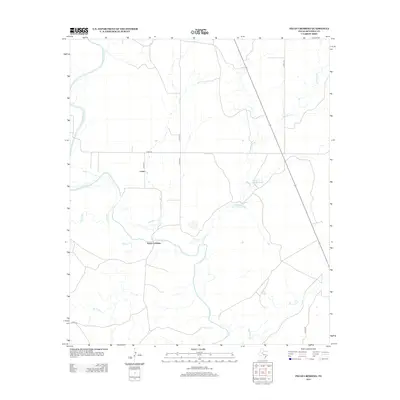
2012 Map of Pecan Crossing
USGS Topo · Published 2012About this map
The Colorado River winds through this West Texas landscape, defining the rural character of Mitchell County. At the heart of the area lies Pecan Crossing, a namesake location where the river is joined by Willow Cr and Beals Cr. The terrain is marked by a network of ranch roads, including Co RD 121 and Co RD 343, which connect the scattered settlements and agricultural sites.
Find a feature on this map
17 named features on this map. Tap any name to fly to it.
Don’t see what you’re looking for? This feature index may not catch every label — zoom into the map to look around manually.
Map Details
Editions of this 2012 Pecan Crossing Map
This is the sole edition of this map. No revisions or reprints were ever made.
Other maps of this area

1950 · Lake Colorado City
USGS Topo · 1:24,000

1950 · Colorado City SE
USGS Topo · 1:24,000

1954 · Big Spring
USGS Topo · 1:250,000

1958 · Big Spring
USGS Topo · 1:250,000

1959 · Pecan Crossing
USGS Topo · 1:24,000

1959 · Dam Draw
USGS Topo · 1:24,000

1959 · Silver
USGS Topo · 1:24,000

1959 · Spade Ranch
USGS Topo · 1:24,000

1959 · McWhorter Mountain
USGS Topo · 1:24,000

1959 · Dead Indian Mountain
USGS Topo · 1:24,000