
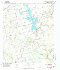
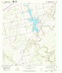
1950 Map of Lake Colorado City
USGS Topo · Published 1952About this map
Lake Colorado City dominates this 1950s landscape, serving as a central hub for industrial and agricultural infrastructure in Mitchell County. The reservoir's eastern shore is anchored by a Power Plant and Canal, while its waters are fed by the confluence of Morgan Creek and the meandering Colorado River. This era shows a transition in local community life, marked by the presence of Dorn Ch and the specifically noted Dorn Sch (Abandoned), suggesting shifting settlement patterns near the water's edge.
Find a feature on this map
23 named features on this map. Tap any name to fly to it.
Don’t see what you’re looking for? This feature index may not catch every label — zoom into the map to look around manually.
Map Details
Editions of this 1950 Lake Colorado City Map
3 editions found
Other maps of this area

1950 · Cedar Bend
USGS Topo · 1:24,000

1950 · Colorado City SE
USGS Topo · 1:24,000

1952 · Cuthbert
USGS Topo · 1:24,000

1952 · Westbrook
USGS Topo · 1:24,000

1952 · Colorado City
USGS Topo · 1:24,000

1954 · Big Spring
USGS Topo · 1:250,000

1958 · Big Spring
USGS Topo · 1:250,000

1959 · Pecan Crossing
USGS Topo · 1:24,000

1959 · Spade Ranch
USGS Topo · 1:24,000

1962 · Hyman NE
USGS Topo · 1:24,000