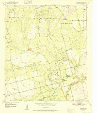
1950 Map of Lake Colorado City
USGS Topo · Published 1979About this map
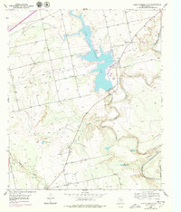
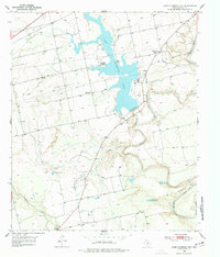
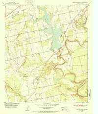
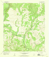
Lake Colorado City dominates this West Texas landscape, formed by the impoundment of Morgan Creek and serving as a critical water source and industrial hub. The presence of the Power Plant and Emergency Spillway underscores the mid-century transformation of this arid region into a managed utility corridor. Along the Colorado River, the terrain features sharp meanders like Horseshoe Bend, where the natural waterway continues south of the reservoir.
Find a feature on this map
19 named features on this map. Tap any name to fly to it.
Don’t see what you’re looking for? This feature index may not catch every label — zoom into the map to look around manually.
Map Details
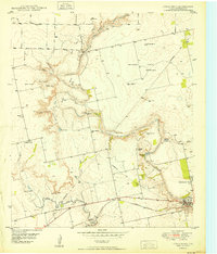
Editions of this 1950 Lake Colorado City Map
3 editions found
Other maps of this area
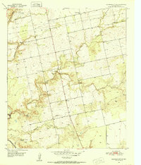
1950 · Cedar Bend
USGS Topo · 1:24,000
1950 · Lake Colorado City
USGS Topo · 1:24,000
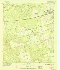
1950 · Colorado City SE
USGS Topo · 1:24,000
1952 · Cuthbert
USGS Topo · 1:24,000
1952 · Westbrook
USGS Topo · 1:24,000
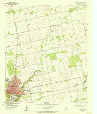
1952 · Colorado City
USGS Topo · 1:24,000

1954 · Big Spring
USGS Topo · 1:250,000

1958 · Big Spring
USGS Topo · 1:250,000
1959 · Pecan Crossing
USGS Topo · 1:24,000
1959 · Spade Ranch
USGS Topo · 1:24,000