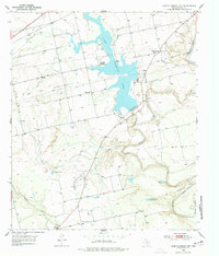
1950 Map of Lake Colorado City
USGS Topo · Published 1977About this map
Lake Colorado City dominates this West Texas landscape, a man-made reservoir fed by a Canal and protected by an Emergency Spillway. The presence of a Power Plant at the lakeside indicates the industrial utility of the water supply in the post-war era. To the south and west, the terrain is defined by the winding paths of Morgan Creek, Camp Creek, and Wildhorse Creek, which all feed toward the Colorado River as it loops through Horseshoe Bend.
Find a feature on this map
22 named features on this map. Tap any name to fly to it.
Don’t see what you’re looking for? This feature index may not catch every label — zoom into the map to look around manually.
Map Details
Editions of this 1950 Lake Colorado City Map
3 editions found
Other maps of this area

1950 · Cedar Bend
USGS Topo · 1:24,000

1950 · Lake Colorado City
USGS Topo · 1:24,000

1950 · Colorado City SE
USGS Topo · 1:24,000

1952 · Cuthbert
USGS Topo · 1:24,000

1952 · Westbrook
USGS Topo · 1:24,000

1952 · Colorado City
USGS Topo · 1:24,000

1954 · Big Spring
USGS Topo · 1:250,000

1958 · Big Spring
USGS Topo · 1:250,000

1959 · Pecan Crossing
USGS Topo · 1:24,000

1959 · Spade Ranch
USGS Topo · 1:24,000