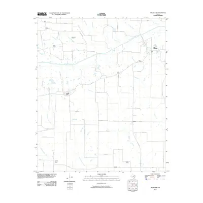
2010 Map of Pecan Gap
USGS Topo · Published 2010About this map
The North Sulphur River and its numerous tributaries, including Doctors Creek and Whittenburg Creek, define the drainage of this northeastern Texas landscape. Rural settlements are scattered across the terrain, notably the community of Pecan Gap, which serves as a central hub for the surrounding farm-to-market road network. The map reveals a distinct pattern of small, family or church-affiliated burial grounds such as Broyal Cemetery, Bledsoe Cemetery, and Waller Cemetery, providing a roadmap for genealogical research in Delta County.
Find a feature on this map
68 named features on this map. Tap any name to fly to it.
Don’t see what you’re looking for? This feature index may not catch every label — zoom into the map to look around manually.
Map Details
Editions of this 2010 Pecan Gap Map
This is the sole edition of this map. No revisions or reprints were ever made.
Other maps of this area

1903 · Paris
USGS Topo · 1:125,000

1947 · Honey Grove
USGS Topo · 1:62,500

1948 · Paris
USGS Topo · 1:62,500

1949 · Honey Grove
USGS Topo · 1:62,500

1949 · Paris
USGS Topo · 1:62,500

1953 · Texarkana
USGS Topo · 1:250,000

1956 · Texarkana
USGS Topo · 1:250,000

1964 · Klondike
USGS Topo · 1:24,000

1964 · Commerce North
USGS Topo · 1:24,000

1964 · Cooper North
USGS Topo · 1:24,000