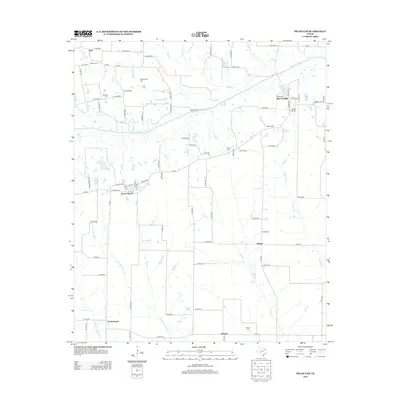
2013 Map of Pecan Gap
USGS Topo · Published 2013About this map
Pecan Gap serves as the primary hub in this corner of Delta County, situated near the headwaters of numerous creeks that feed into the N Sulphur River. The landscape is a network of rural county roads connecting small settlements and family burial grounds, reflecting a long history of agricultural settlement. Local genealogists will find several distinct cemeteries such as Broyal Cem and the Baptist Hill Cem near Ben Franklin.
Find a feature on this map
94 named features on this map. Tap any name to fly to it.
Don’t see what you’re looking for? This feature index may not catch every label — zoom into the map to look around manually.
Map Details
Editions of this 2013 Pecan Gap Map
This is the sole edition of this map. No revisions or reprints were ever made.
Other maps of this area

1903 · Paris
USGS Topo · 1:125,000

1947 · Honey Grove
USGS Topo · 1:62,500

1948 · Paris
USGS Topo · 1:62,500

1949 · Honey Grove
USGS Topo · 1:62,500

1949 · Paris
USGS Topo · 1:62,500

1953 · Texarkana
USGS Topo · 1:250,000

1956 · Texarkana
USGS Topo · 1:250,000

1964 · Klondike
USGS Topo · 1:24,000

1964 · Commerce North
USGS Topo · 1:24,000

1964 · Cooper North
USGS Topo · 1:24,000