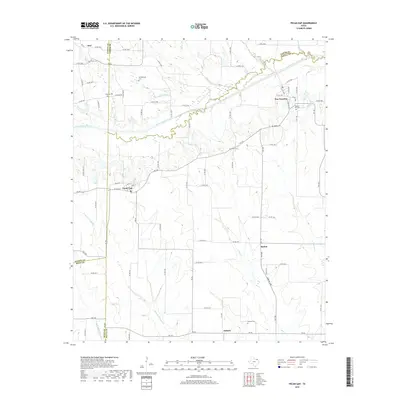
2019 Map of Pecan Gap
USGS Topo · Published 2019About this map
The North Sulphur River cuts an east-west path through the blackland prairies of Delta and Lamar Counties, defining the drainage patterns for this agricultural region. Small communities like Pecan Gap and Ben Franklin serve as local hubs, connected by a network of farm-to-market roads and county routes that trace the section lines of the Texas landscape. The map provides a detailed look at the rural heritage of the area, preserving the locations of numerous family and community burial sites such as Whittenburg Cem, Baptist Hill Cem, and Royal Cem.
Find a feature on this map
92 named features on this map. Tap any name to fly to it.
Don’t see what you’re looking for? This feature index may not catch every label — zoom into the map to look around manually.
Map Details
Editions of this 2019 Pecan Gap Map
This is the sole edition of this map. No revisions or reprints were ever made.
Other maps of this area

1903 · Paris
USGS Topo · 1:125,000

1947 · Honey Grove
USGS Topo · 1:62,500

1948 · Paris
USGS Topo · 1:62,500

1949 · Honey Grove
USGS Topo · 1:62,500

1949 · Paris
USGS Topo · 1:62,500

1953 · Texarkana
USGS Topo · 1:250,000

1956 · Texarkana
USGS Topo · 1:250,000

1964 · Klondike
USGS Topo · 1:24,000

1964 · Commerce North
USGS Topo · 1:24,000

1964 · Cooper North
USGS Topo · 1:24,000