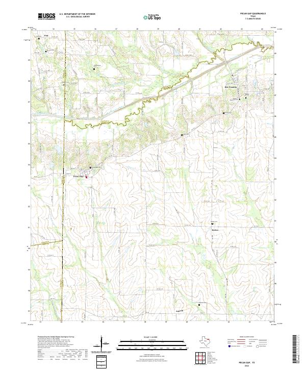
2022 Map of Pecan Gap
USGS Topo · Published 2022About this map
The North Sulphur River serves as the prominent boundary line between Lamar and Delta counties, carving through a landscape defined by small rural settlements and family-named cemeteries. Near the western edge, Pecan Gap remains the primary hub, surrounded by burial grounds such as Pecan Gap Cem and the Bledsoe Cem. To the east, the community of Ben Franklin is marked by the Garden of Memories Cem and Baptist Hill Cem, illustrating the importance of these localized landmarks in tracing family history within this agricultural corridor.
Find a feature on this map
96 named features on this map. Tap any name to fly to it.
Don’t see what you’re looking for? This feature index may not catch every label — zoom into the map to look around manually.
Map Details
Editions of this 2022 Pecan Gap Map
This is the sole edition of this map. No revisions or reprints were ever made.
Other maps of this area

1903 · Paris
USGS Topo · 1:125,000

1947 · Honey Grove
USGS Topo · 1:62,500

1948 · Paris
USGS Topo · 1:62,500

1949 · Honey Grove
USGS Topo · 1:62,500

1949 · Paris
USGS Topo · 1:62,500

1953 · Texarkana
USGS Topo · 1:250,000

1956 · Texarkana
USGS Topo · 1:250,000

1964 · Klondike
USGS Topo · 1:24,000

1964 · Commerce North
USGS Topo · 1:24,000

1964 · Cooper North
USGS Topo · 1:24,000