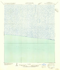
1954 Map of Pecan Island SW
USGS Topo · Published 1954About this map
Pirogue Trail cuts through the marshlands of southern Vermilion Parish in this mid-century survey. The landscape is dominated by expansive wetlands and coastal transition zones where the land meets the Gulf of Mexico. A singular landform, Mulberry Island, sits along the coastline, representing one of the few named topographical features in this hydrologically active environment. Compiled from aerial photography taken by the U.S. Army Air Corps, the map illustrates the intricate drainage patterns and shallow water passages essential for navigation before the region's modern development. The presence of the pirogue trail highlights the traditional reliance on small, shallow-draft watercraft for traversing the Louisiana coastal marshes during the early twentieth century.
Find a feature on this map
3 named features on this map. Tap any name to fly to it.
Don’t see what you’re looking for? This feature index may not catch every label — zoom into the map to look around manually.
Map Details
Editions of this 1954 Pecan Island SW Map
This is the sole edition of this map. No revisions or reprints were ever made.
Other maps of this area

1932 · Constance Bayou NE
USGS Topo · 1:31,680

1932 · Pecan Island SE
USGS Topo · 1:31,680

1932 · Pecan Island SW
USGS Topo · 1:31,680

1932 · Constance Bayou SE
USGS Topo · 1:31,680

1945 · Pecan Island NW
USGS Topo · 1:31,680

1945 · Pecan Island NE
USGS Topo · 1:31,680

1951 · Pecan Island
USGS Topo · 1:62,500
1954 · Constance Bayou SE
USGS Topo · 1:31,680
1954 · Pecan Island NE
USGS Topo · 1:31,680

1954 · Port Arthur
USGS Topo · 1:250,000