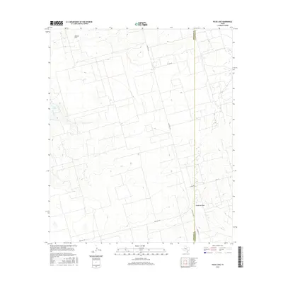
2016 Map of Pecks Lake
USGS Topo · Published 2016About this map
Pecks Lake and its surrounding high plains landscape are documented in this 2016 survey, which details the sparse hydrography of the Llano Estacado. The map centers on the drainage patterns of the region, specifically Pemberton Draw and Johnson Draw, which weave through the terrain. The eastern edge of the sheet follows the administrative boundary between Midland County and Glasscock County, providing a clear record of land division in this section of West Texas.
Find a feature on this map
9 named features on this map. Tap any name to fly to it.
Don’t see what you’re looking for? This feature index may not catch every label — zoom into the map to look around manually.
Map Details
Editions of this 2016 Pecks Lake Map
This is the sole edition of this map. No revisions or reprints were ever made.
Other maps of this area

1954 · San Angelo
USGS Topo · 1:250,000

1958 · San Angelo
USGS Topo · 1:250,000

1965 · San Angelo
USGS Topo · 1:250,000

1965 · Dewey Lake
USGS Topo · 1:24,000

1965 · Spraberry
USGS Topo · 1:24,000

1965 · Salt Lake
USGS Topo · 1:24,000

1965 · Pecks Lake
USGS Topo · 1:24,000
1965 · Stephenson Lake
USGS Topo · 1:24,000

1965 · Patterson Lake
USGS Topo · 1:24,000

1967 · Midkiff
USGS Topo · 1:24,000