
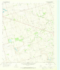
1965 Map of Pecks Lake
USGS Topo · Published 1966About this map
The boundary between Midland Co Glasscock Co runs through a landscape defined by industrial development and water management in the mid-1960s. The presence of the Spraberry Gas Plant and several Quarry sites reflects the region's reliance on mineral and fuel extraction. Surface water is sparse, marked primarily by the seasonal drainage of Pemberton Draw and Johnson Draw, which lead toward the localized basin of Pecks Lake.
Find a feature on this map
9 named features on this map. Tap any name to fly to it.
Don’t see what you’re looking for? This feature index may not catch every label — zoom into the map to look around manually.
Map Details
Editions of this 1965 Pecks Lake Map
This is the sole edition of this map. No revisions or reprints were ever made.
Other maps of this area

1954 · San Angelo
USGS Topo · 1:250,000

1958 · San Angelo
USGS Topo · 1:250,000

1965 · San Angelo
USGS Topo · 1:250,000

1965 · Dewey Lake
USGS Topo · 1:24,000

1965 · Spraberry
USGS Topo · 1:24,000

1965 · Salt Lake
USGS Topo · 1:24,000
1965 · Stephenson Lake
USGS Topo · 1:24,000

1965 · Patterson Lake
USGS Topo · 1:24,000

1967 · Midkiff
USGS Topo · 1:24,000

1968 · Midkiff NW
USGS Topo · 1:24,000