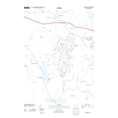
2013 Map of Pecks Pond
USGS Topo · Published 2013About this map
Lords Valley and the expansive residential network of Hemlock Farms anchor this 2013 survey of the northern Poconos. The landscape is defined by its diverse water bodies and recreational infrastructure, ranging from the large Pecks Pond with its central Pinchot Island to the secluded Lake Giles and the Shohola Marsh Reservoir. Notable public land features include the Tarkill Demonstration Area and the Pecks Pond Picnic Area, reflecting the area's long-standing role as a destination for outdoor enthusiasts.
Find a feature on this map
170 named features on this map. Tap any name to fly to it.
Don’t see what you’re looking for? This feature index may not catch every label — zoom into the map to look around manually.
Map Details
Editions of this 2013 Pecks Pond Map
This is the sole edition of this map. No revisions or reprints were ever made.
Other maps of this area

1891 · Wallpack
USGS Topo · 1:62,500

1893 · Wallpack
USGS Topo · 1:62,500

1913 · Milford
USGS Topo · 1:62,500

1915 · Milford
USGS Topo · 1:62,500

1924 · Bushkill
USGS Topo · 1:48,000

1935 · Hawley
USGS Topo · 1:62,500

1938 · Hawley
USGS Topo · 1:62,500

1943 · Bushkill
USGS Topo · 1:62,500

1943 · Lake Maskenozha
USGS Topo · 1:31,680
1943 · Twelvemile Pond
USGS Topo · 1:24,000
Featured Places
- Blooming Grove Township, PA
- Greene Township, PA
- Dingman Township, PA
- Pecks Pond, Porter Township
- Hemlock Farms, Blooming Grove Township