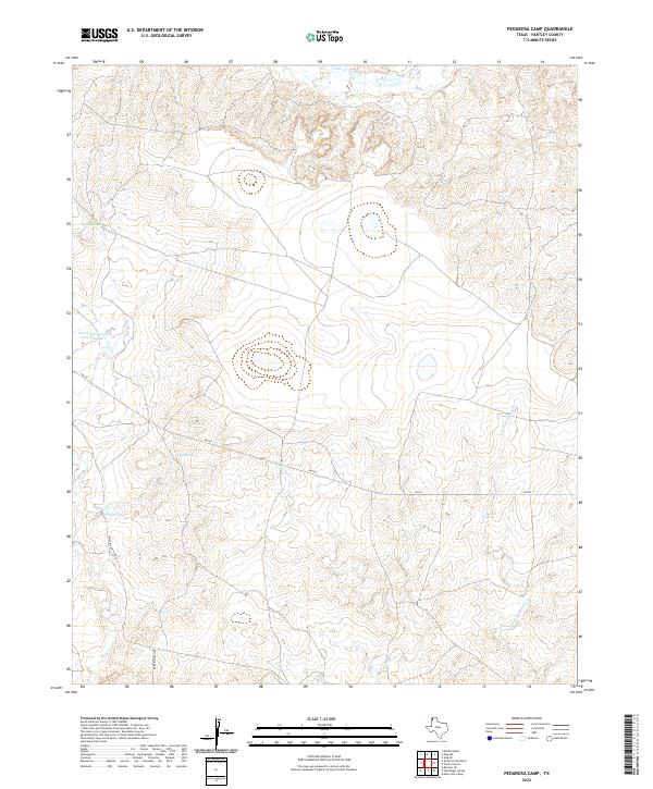
2022 Map of Pedarosa Camp
USGS Topo · Published 2022About this map
The High Plains of Hartley County are defined here by a network of ephemeral watercourses and vital watering holes essential for West Texas ranching. Water management is central to the landscape, evidenced by the presence of New Tank and the Spring Dam located in the northwest. Several significant drainages, including Punta de Agua Cr and Romero Cr, carve through the terrain, leading toward larger basins. Named landmarks like Martha Houghton Lake Number 1 reflect family legacies tied to this arid region. Remote travel is facilitated by FM 767 and Griffin Ranch Rd, which provide access to interior points like Red Spring and Antelope Spring. This documentation captures the area's ongoing reliance on localized springs and creeks for livestock and land use.
Find a feature on this map
11 named features on this map. Tap any name to fly to it.
Don’t see what you’re looking for? This feature index may not catch every label — zoom into the map to look around manually.
Map Details
Editions of this 2022 Pedarosa Camp Map
This is the sole edition of this map. No revisions or reprints were ever made.
Other maps of this area

1954 · Tucumcari
USGS Topo · 1:250,000

1958 · Tucumcari
USGS Topo · 1:250,000

1971 · Middle Water
USGS Topo · 1:24,000

1971 · Romero SE
USGS Topo · 1:24,000

1971 · Proctor Ranch
USGS Topo · 1:24,000

1971 · Spring Creek Ranch
USGS Topo · 1:24,000

1971 · Many Post Camp
USGS Topo · 1:24,000
1971 · Humdinger Spring
USGS Topo · 1:24,000

1971 · Pedarosa Camp
USGS Topo · 1:24,000

1973 · King SW
USGS Topo · 1:24,000