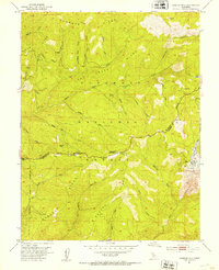
1951 Map of Peddler Hill
USGS Topo · Published 1953About this map
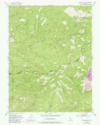
Eldorado National Forest dominates the landscape of the Sierra Nevada foothills in this 1951 study, showing a region defined by high ridges and timber industry infrastructure. The survey was conducted just as the Lower Bear River Reservoir was beginning to shape the local hydrology, with dashed lines indicating the projected water levels. Resource extraction and transit are central to the map's character, evidenced by the Caldor Logging Road traversing the northern ridges and the presence of the Tiger Mine near Greilich Camp. Along the southern boundary between El Dorado and Amador counties, the Lumberyard Ranger Station and Hams Station serve as primary human outposts. The terrain is marked by a series of prominent elevations, including Plummer Ridge and Beaver Ridge, which channel the Middle Fork Cosumnes River and its numerous tributaries such as Shingle Mill Creek.
Find a feature on this map
40 named features on this map. Tap any name to fly to it.
Don’t see what you’re looking for? This feature index may not catch every label — zoom into the map to look around manually.
Map Details
Editions of this 1951 Peddler Hill Map
5 editions found
Other maps of this area

1889 · Pyramid Peak
USGS Topo · 1:125,000

1891 · Big Trees
USGS Topo · 1:125,000

1891 · Pyramid Peak
USGS Topo · 1:125,000

1894 · Big Trees
USGS Topo · 1:125,000

1895 · Pyramid Peak
USGS Topo · 1:125,000

1896 · Pyramid Peak
USGS Topo · 1:125,000

1897 · Big Trees
USGS Topo · 1:125,000

1901 · Big Trees
USGS Topo · 1:125,000

1947 · Sacramento
USGS Topo · 1:250,000

1948 · Sacramento
USGS Topo · 1:250,000