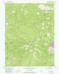
1951 Map of Peddler Hill
USGS Topo · Published 1980About this map
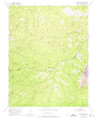
Eldorado National Forest defines the character of this 1951 survey, capturing a high-elevation landscape structured by ridges and deep river canyons along the El Dorado and Amador county line. The terrain is marked by the Middle Fork Cosumnes River and numerous drainages like Beaver Creek and Rattlesnake Creek. Economic activity is evidenced by the Tiger Mine, a Quarry, and the winding Caldor Logging Road, reflecting the region's reliance on timber and mineral extraction. Early infrastructure and forest management are visible at the Lumberyard Ranger Station and Lynch Dam. For genealogists and local historians, small outposts like Hams Station and Greilich Camp provide specific points of human settlement. The 1973 photorevisions include newer recreational developments like the Ski Lodge near Peddler Hill and the Lower Bear River Reservoir at the southeastern edge.
Find a feature on this map
50 named features on this map. Tap any name to fly to it.
Don’t see what you’re looking for? This feature index may not catch every label — zoom into the map to look around manually.
Map Details
Editions of this 1951 Peddler Hill Map
5 editions found
Other maps of this area

1889 · Pyramid Peak
USGS Topo · 1:125,000

1891 · Big Trees
USGS Topo · 1:125,000

1891 · Pyramid Peak
USGS Topo · 1:125,000

1894 · Big Trees
USGS Topo · 1:125,000

1895 · Pyramid Peak
USGS Topo · 1:125,000

1896 · Pyramid Peak
USGS Topo · 1:125,000

1897 · Big Trees
USGS Topo · 1:125,000

1901 · Big Trees
USGS Topo · 1:125,000

1947 · Sacramento
USGS Topo · 1:250,000

1948 · Sacramento
USGS Topo · 1:250,000