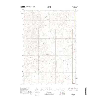
2017 Map of Pedro SE
USGS Topo · Published 2017About this map
Stony Buttes rises as a prominent landmark in this western South Dakota landscape, overlooking a network of drainages that define the local topography. This 2017 survey shows the intricate erosion patterns of the region, where Stony Buttes Draw and Seven D Draw carve into the terrain. The hydrology of the area is characterized by intermittent watercourses like Mixes Food Cr and the E Fork Deep Cr, which eventually joins with Deep Cr. Located along the border of Pennington and Haakon counties, the area is traversable via rural routes such as Quinn-Pedro Rd and Oconnell Rd. The map illustrates a primarily open range environment, punctuated by named draws and creeks that have long served as vital reference points for local ranchers and land managers in this high plains setting.
Find a feature on this map
18 named features on this map. Tap any name to fly to it.
Don’t see what you’re looking for? This feature index may not catch every label — zoom into the map to look around manually.
Map Details
Editions of this 2017 Pedro SE Map
This is the sole edition of this map. No revisions or reprints were ever made.
Other maps of this area

1953 · Rapid City
USGS Topo · 1:250,000

1954 · Pierre
USGS Topo · 1:250,000

1955 · Pedro
USGS Topo · 1:24,000

1955 · Pedro NW
USGS Topo · 1:24,000

1955 · Creighton
USGS Topo · 1:24,000

1955 · Pedro SE
USGS Topo · 1:24,000

1955 · Hilland NW
USGS Topo · 1:24,000

1957 · Rapid City
USGS Topo · 1:250,000

1958 · Pierre
USGS Topo · 1:250,000

1983 · Post Ranch
USGS Topo · 1:24,000