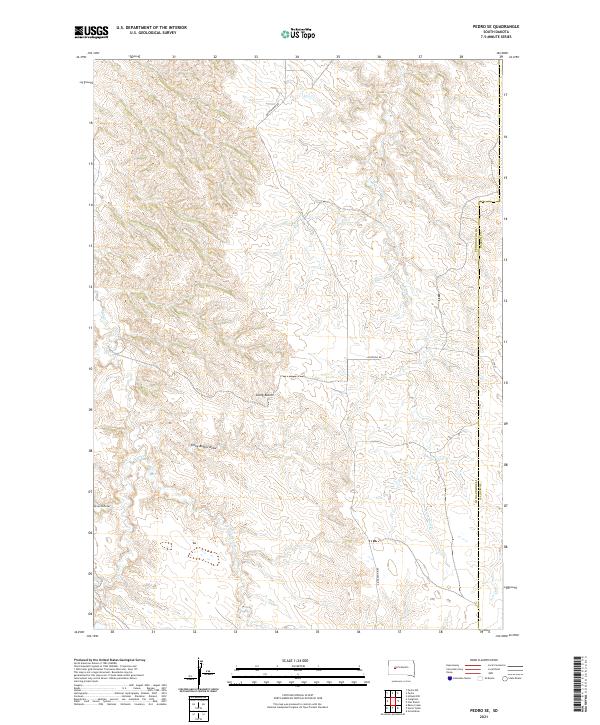
2021 Map of Pedro SE
USGS Topo · Published 2021About this map
Stony Buttes anchors the central landscape of this West River South Dakota survey, serving as a prominent landmark above the surrounding drainage networks. The terrain is defined by a complex system of draws and seasonal waterways, including Stony Buttes Draw and Seven D Draw, which channel into larger basins. This area on the Pennington County and Haakon County line reflects a rural, high-plains environment where water management and access are dictated by the paths of Mixes Food Cr and Deep Cr. Small-scale infrastructure like Quinn-Pedro Rd and Oconnell Rd provide the primary transit through these sections, illustrating the sparse settlement pattern typical of the region's ranching and agricultural history. The convergence of E Fork Deep Cr and Ash Cr further illustrates the hydrological importance of this specific quadrangle within the wider Missouri River watershed.
Find a feature on this map
17 named features on this map. Tap any name to fly to it.
Don’t see what you’re looking for? This feature index may not catch every label — zoom into the map to look around manually.
Map Details
Editions of this 2021 Pedro SE Map
This is the sole edition of this map. No revisions or reprints were ever made.
Other maps of this area

1953 · Rapid City
USGS Topo · 1:250,000

1954 · Pierre
USGS Topo · 1:250,000

1955 · Pedro
USGS Topo · 1:24,000

1955 · Pedro NW
USGS Topo · 1:24,000

1955 · Creighton
USGS Topo · 1:24,000

1955 · Pedro SE
USGS Topo · 1:24,000

1955 · Hilland NW
USGS Topo · 1:24,000

1957 · Rapid City
USGS Topo · 1:250,000

1958 · Pierre
USGS Topo · 1:250,000

1983 · Post Ranch
USGS Topo · 1:24,000