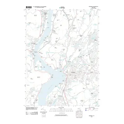
2010 Map of Peekskill
USGS Topo · Published 2010About this map
The Hudson River dominates the western edge of this survey, serving as the historical artery for riverside communities like Peekskill, Verplanck, and Buchanan. The landscape is defined by its deep roots in maritime and military history, featuring the sprawling military reservation of Camp Smith and the historic fortifications at Fort Clinton and Fort Montgomery. Just across the water from Dunderberg Mountain, the town of Peekskill shows a dense network of streets climbing toward Academy Hill, while the nearby residential enclaves of Toddville and Pleasantside expand toward the interior highlands.
Find a feature on this map
162 named features on this map. Tap any name to fly to it.
Don’t see what you’re looking for? This feature index may not catch every label — zoom into the map to look around manually.
Map Details
Editions of this 2010 Peekskill Map
This is the sole edition of this map. No revisions or reprints were ever made.
Other maps of this area

1891 · Ramapo
USGS Topo · 1:62,500

1892 · West Point
USGS Topo · 1:62,500

1892 · Tarrytown
USGS Topo · 1:62,500

1893 · Tarrytown
USGS Topo · 1:62,500

1893 · Ramapo
USGS Topo · 1:62,500

1894 · West Point
USGS Topo · 1:62,500

1899 · West Point
USGS Topo · 1:62,500

1901 · West Point
USGS Topo · 1:62,500

1902 · Tarrytown
USGS Topo · 1:62,500

1902 · Schunemunk
USGS Topo · 1:62,500