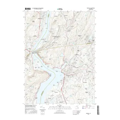
2016 Map of Peekskill
USGS Topo · Published 2016About this map
West Point and the military grounds above the Hudson River define the northern reach of this 2016 survey, where the river narrows between Bare Rock Mtn and Anthonys Nose. The landscape reflects a mix of preserved wildlands and deep-rooted settlements, with the Appalachian National Scenic Trail winding through the highlands near Graymoor and Continental Village. Further south, the urban center of Peekskill sits at the edge of Peekskill Bay, marked by local landmarks like Acad Hill and Drum Hill.
Find a feature on this map
332 named features on this map. Tap any name to fly to it.
Don’t see what you’re looking for? This feature index may not catch every label — zoom into the map to look around manually.
Map Details
Editions of this 2016 Peekskill Map
This is the sole edition of this map. No revisions or reprints were ever made.
Other maps of this area

1891 · Ramapo
USGS Topo · 1:62,500

1892 · West Point
USGS Topo · 1:62,500

1892 · Tarrytown
USGS Topo · 1:62,500

1893 · Tarrytown
USGS Topo · 1:62,500

1893 · Ramapo
USGS Topo · 1:62,500

1894 · West Point
USGS Topo · 1:62,500

1899 · West Point
USGS Topo · 1:62,500

1901 · West Point
USGS Topo · 1:62,500

1902 · Tarrytown
USGS Topo · 1:62,500

1902 · Schunemunk
USGS Topo · 1:62,500