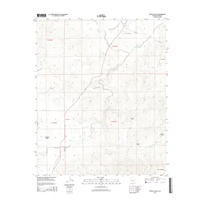
2014 Map of Peeples Valley
USGS Topo · Published 2014About this map
Peeples Valley is situated within a high-elevation landscape defined by the rugged slopes of the Weaver Mountains and a complex network of seasonal drainages. This high-desert terrain is carved by notable watercourses like Kirkland Creek, Model Cr, and Arrastre Cr, which create the deep cuts of French Gulch and Placerita Gulch. The importance of water management in this arid region is evident through the naming of localized catchments such as Tin Can Tank, Condon Tank, and Box Canyon Tank. The map shows a modest but persistent ranching and rural residential infrastructure, with roads like Rancho El Oso Rd and W Hays Ranch Rd providing access across the township lines of T11N and T12N. Landforms like Sourgrass Flat and Mahoney Ridge further distinguish the varied topography of this southwestern Yavapai County district.
Find a feature on this map
34 named features on this map. Tap any name to fly to it.
Don’t see what you’re looking for? This feature index may not catch every label — zoom into the map to look around manually.
Map Details
Editions of this 2014 Peeples Valley Map
This is the sole edition of this map. No revisions or reprints were ever made.
Other maps of this area

1887 · Prescott
USGS Topo · 1:250,000

1892 · Prescott
USGS Topo · 1:250,000

1903 · Congress
USGS Topo · 1:125,000

1904 · Congress
USGS Topo · 1:125,000

1947 · Kirkland
USGS Topo · 1:62,500

1947 · Wagoner
USGS Topo · 1:62,500

1948 · Kirkland
USGS Topo · 1:63,360

1948 · Wagoner
USGS Topo · 1:63,360

1950 · Wagoner
USGS Topo · 1:62,500
1950 · Kirkland
USGS Topo · 1:62,500