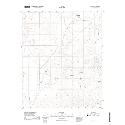
2018 Map of Peeples Valley
USGS Topo · Published 2018About this map
Peeples Valley and Kirkland Junction serve as the primary nodes of settlement in this high-desert landscape of central Arizona. The area is defined by a series of ranch-access roads like White Head Ranch Rd and Ruger Ranch Rd, which navigate the complex drainage systems of Kirkland Creek and its many tributaries. The transition from the alluvial flats of Sourgrass Flat to the rising terrain of the Weaver Mountains in the southeast corner illustrates the topographical variety of Yavapai County. Local history is anchored by landmarks such as Genung Memorial Park and Genung Spring, while the presence of named water features like Tin Can Tank and Condon Tank highlights the essential water management infrastructure required for ranching in this environment.
Find a feature on this map
43 named features on this map. Tap any name to fly to it.
Don’t see what you’re looking for? This feature index may not catch every label — zoom into the map to look around manually.
Map Details
Editions of this 2018 Peeples Valley Map
This is the sole edition of this map. No revisions or reprints were ever made.
Other maps of this area

1887 · Prescott
USGS Topo · 1:250,000

1892 · Prescott
USGS Topo · 1:250,000

1903 · Congress
USGS Topo · 1:125,000

1904 · Congress
USGS Topo · 1:125,000

1947 · Kirkland
USGS Topo · 1:62,500

1947 · Wagoner
USGS Topo · 1:62,500

1948 · Kirkland
USGS Topo · 1:63,360

1948 · Wagoner
USGS Topo · 1:63,360

1950 · Wagoner
USGS Topo · 1:62,500
1950 · Kirkland
USGS Topo · 1:62,500