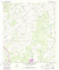
1965 Map of Peggy
USGS Topo · Published 1986About this map
Esseville and Peggy anchor this rural Texas landscape during the mid-1960s, a region defined by its creek drainages and intermittent waterways. The topography is shaped by the Lipan Hills in the northwest, where the Lipan Hills Aqueduct and Hacienda de la Tordilla are located. This era of the South Texas brush country shows a heavy reliance on local infrastructure, with multiple gravel pits and a network of pipelines crossing the terrain near Salt Branch and West Weedy Creek. Genealogical interest is found at the Pleasant Hill Cemetery and an additional unnamed Cem located near the center of the survey. The presence of numerous benchmarks and wells suggests an active period of resource management and land surveying along the Atascosa Co Live Oak Co line, providing a clear view of the ranching and industrial footprint before later 20th-century developments.
Find a feature on this map
28 named features on this map. Tap any name to fly to it.
Don’t see what you’re looking for? This feature index may not catch every label — zoom into the map to look around manually.
Map Details
Editions of this 1965 Peggy Map
2 editions found
Other maps of this area

1930 · Whitsett
USGS Topo · 1:62,500

1931 · Falls City
USGS Topo · 1:62,500

1942 · Whitsett
USGS Topo · 1:62,500

1953 · Crystal City
USGS Topo · 1:250,000

1955 · Crystal City
USGS Topo · 1:250,000

1956 · Suniland
USGS Topo · 1:62,500

1956 · Pleasanton
USGS Topo · 1:62,500

1961 · Crystal City
USGS Topo · 1:250,000
1961 · Coy City
USGS Topo · 1:24,000
1961 · Fashing
USGS Topo · 1:24,000