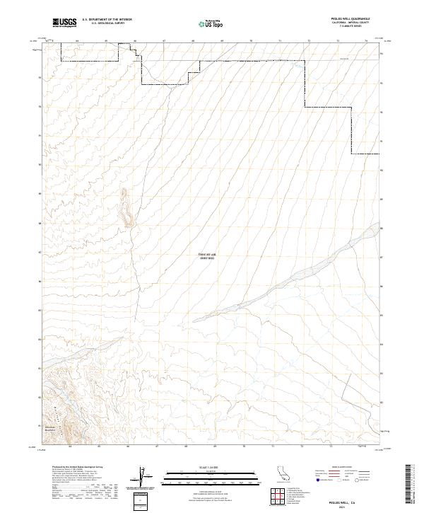
2021 Map of Pegleg Well
USGS Topo · Published 2021About this map
The southern foothills of the Chocolate Mountains define the arid landscape of this Imperial County desert region. Low-lying drainages including Arroyo Seco and Martinez Gulch cut through the terrain, illustrating the natural water runoff patterns that shape the local topography. This 2021 topographic study reflects the modern geography of this sparsely populated area, where Skyline Dr provides one of the few navigational markers across the high desert. The map captures the intersection of several township and range boundaries, specifically where T9S and T10S meet across R16E, R17E, and R18E, providing essential data for land ownership and boundary research in a region dominated by its stark physical features.
Find a feature on this map
12 named features on this map. Tap any name to fly to it.
Don’t see what you’re looking for? This feature index may not catch every label — zoom into the map to look around manually.
Map Details
Editions of this 2021 Pegleg Well Map
This is the sole edition of this map. No revisions or reprints were ever made.
Other maps of this area

1940 · Iris
USGS Topo · 1:62,500

1940 · Iris Pass
USGS Topo · 1:62,500

1945 · Iris Pass
USGS Topo · 1:62,500

1945 · Iris
USGS Topo · 1:62,500

1953 · Chuckwalla Spring
USGS Topo · 1:62,500

1953 · Acolita
USGS Topo · 1:62,500

1954 · Salton Sea
USGS Topo · 1:250,000

1955 · Tortuga
USGS Topo · 1:24,000

1955 · Salton Sea
USGS Topo · 1:250,000

1959 · Salton Sea
USGS Topo · 1:250,000