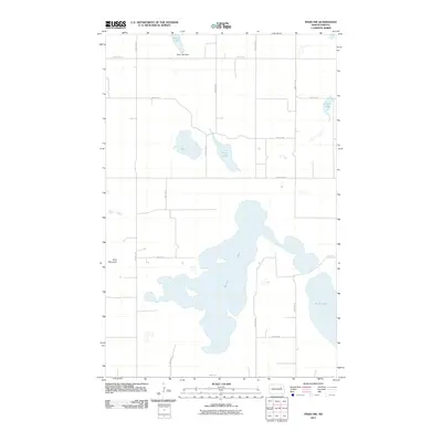
2011 Map of Pekin NW
USGS Topo · Published 2011About this map
Stump Lake dominates the southern half of this landscape, its irregular shoreline and surrounding wetlands characteristic of the drift prairie's glaciated terrain. The hydrology of the area is defined by a series of smaller basins to the north, including Swan Lake and Coon Lake, along with the managed waters of Rose Lake and the Rose Lake Dam. A regular grid of section roads, such as County Rd 23 and 99th Ave NE, partitions the countryside, reflecting the late 19th-century public land survey system that organized this agricultural region. The most prominent elevation in the vicinity is Blue Mountain, rising west of the expansive waters of Stump Lake. This survey provides a clear view of the rural infrastructure and natural drainage patterns in Nelson County before more recent environmental changes altered the water levels in these terminal basins.
Find a feature on this map
19 named features on this map. Tap any name to fly to it.
Don’t see what you’re looking for? This feature index may not catch every label — zoom into the map to look around manually.
Map Details
Editions of this 2011 Pekin NW Map
This is the sole edition of this map. No revisions or reprints were ever made.
Other maps of this area

1930 · Pekin
USGS Topo · 1:62,500

1930 · Hamar
USGS Topo · 1:62,500

1950 · Devils Lake Mountain
USGS Topo · 1:24,000

1951 · Pekin NE
USGS Topo · 1:24,000

1951 · Devils Lake Mountain
USGS Topo · 1:24,000

1951 · Pekin NW
USGS Topo · 1:24,000

1951 · Tolna
USGS Topo · 1:24,000

1951 · Pekin
USGS Topo · 1:24,000

1951 · Pekin
USGS Topo · 1:62,500

1952 · New Rockford
USGS Topo · 1:250,000