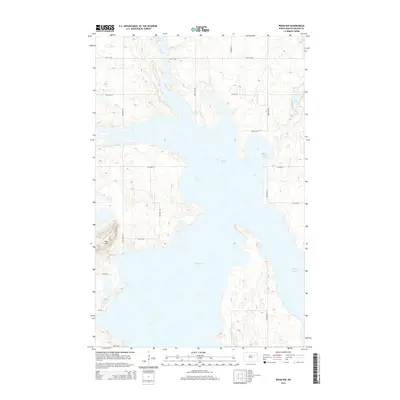
2014 Map of Pekin NW
USGS Topo · Published 2014About this map
Stump Lake dominates this Nelson County landscape, its expansive waters and irregular shoreline defining the local geography. The area is characterized by a dense network of glacial lakes including Swan Lake, Rose Lake, and the smaller Coon Lake to the northeast. This 2014 survey reveals a transition in the hydrological patterns of the region, where the rising and receding waters of these lakes significantly alter the available land for agriculture and transport. The terrain rises to a localized high point at Blue Mtn in the west, while a grid of county roads like Co Road 23 and 100th Ave NE navigate the complex margins between the wetlands and the prairie. The map provides a clear record of the rural infrastructure maintained to serve the isolated farmsteads and lakefront properties of central North Dakota.
Find a feature on this map
20 named features on this map. Tap any name to fly to it.
Don’t see what you’re looking for? This feature index may not catch every label — zoom into the map to look around manually.
Map Details
Editions of this 2014 Pekin NW Map
This is the sole edition of this map. No revisions or reprints were ever made.
Other maps of this area

1930 · Pekin
USGS Topo · 1:62,500

1930 · Hamar
USGS Topo · 1:62,500

1950 · Devils Lake Mountain
USGS Topo · 1:24,000

1951 · Pekin NE
USGS Topo · 1:24,000

1951 · Devils Lake Mountain
USGS Topo · 1:24,000

1951 · Pekin NW
USGS Topo · 1:24,000

1951 · Tolna
USGS Topo · 1:24,000

1951 · Pekin
USGS Topo · 1:24,000

1951 · Pekin
USGS Topo · 1:62,500

1952 · New Rockford
USGS Topo · 1:250,000