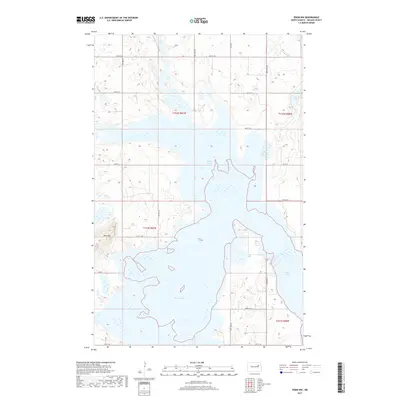
2017 Map of Pekin NW
USGS Topo · Published 2017About this map
Stump Lake dominates this Nelson County landscape, revealing an intricate system of bays and wetlands that define the hydrology of north-central North Dakota. The northern portion of the quadrangle is punctuated by several smaller water bodies, including Rose Lake, Coon Lake, and the winding Swan Lake. This 2017 study illustrates the distinct glacial topography of the region, where slight elevation changes like Blue Mtn rise above the surrounding plains. The rural infrastructure is laid out in a precise grid, following the Public Land Survey System divisions of townships T152N and T151N. Roads such as Co Rd 15 and Co Rd 23 provide access across the basin, connecting scattered agricultural holdings and shoreline areas in a terrain primarily shaped by the fluctuating levels of these prairie lakes.
Find a feature on this map
19 named features on this map. Tap any name to fly to it.
Don’t see what you’re looking for? This feature index may not catch every label — zoom into the map to look around manually.
Map Details
Editions of this 2017 Pekin NW Map
This is the sole edition of this map. No revisions or reprints were ever made.
Other maps of this area

1930 · Pekin
USGS Topo · 1:62,500

1930 · Hamar
USGS Topo · 1:62,500

1950 · Devils Lake Mountain
USGS Topo · 1:24,000

1951 · Pekin NE
USGS Topo · 1:24,000

1951 · Devils Lake Mountain
USGS Topo · 1:24,000

1951 · Pekin NW
USGS Topo · 1:24,000

1951 · Tolna
USGS Topo · 1:24,000

1951 · Pekin
USGS Topo · 1:24,000

1951 · Pekin
USGS Topo · 1:62,500

1952 · New Rockford
USGS Topo · 1:250,000