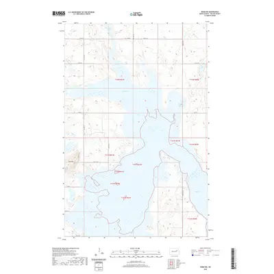
2020 Map of Pekin NW
USGS Topo · Published 2020About this map
Stump Lake and its evolving shoreline dominate this section of Nelson County, where the fluctuating water levels characteristic of the region’s endorheic basins are clearly visible. The landscape is a complex network of wetlands and permanent water bodies, including Swan Lake, Rose Lake, and Coon Lake, which reflect the glacial history of the North Dakota prairies. Elevation changes are subtle across this terrain, though Blue Mtn provides a distinct topographic rise in the southwestern portion of the quadrangle. The human imprint is defined by a rigid section-line road grid, with routes like Co RD 23, Co RD 15, and Co RD 4 providing access to the agricultural parcels that surround these shifting waters. This survey captures a moment in the modern era where the interaction between the natural prairie potholes and the regional road network is precisely delineated.
Find a feature on this map
17 named features on this map. Tap any name to fly to it.
Don’t see what you’re looking for? This feature index may not catch every label — zoom into the map to look around manually.
Map Details
Editions of this 2020 Pekin NW Map
This is the sole edition of this map. No revisions or reprints were ever made.
Other maps of this area

1930 · Pekin
USGS Topo · 1:62,500

1930 · Hamar
USGS Topo · 1:62,500

1950 · Devils Lake Mountain
USGS Topo · 1:24,000

1951 · Pekin NE
USGS Topo · 1:24,000

1951 · Devils Lake Mountain
USGS Topo · 1:24,000

1951 · Pekin NW
USGS Topo · 1:24,000

1951 · Tolna
USGS Topo · 1:24,000

1951 · Pekin
USGS Topo · 1:24,000

1951 · Pekin
USGS Topo · 1:62,500

1952 · New Rockford
USGS Topo · 1:250,000