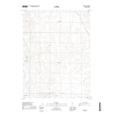
2018 Map of Peko Peak
USGS Topo · Published 2018About this map
Peko Peak and the surrounding high desert of Elko County are detailed in this 2018 U.S. Geological Survey update. The landscape is defined by the sinuous path of the N Fork Humboldt River, which cuts through the western portion of the quadrangle near the prominent geological gap at Devils Gate. The terrain rises from the river valley into the Peko Hills and the Mallard Hills, creating a complex network of seasonal drainages including Pole Cr, Allen Cr, and Gopher Cr.
Find a feature on this map
19 named features on this map. Tap any name to fly to it.
Don’t see what you’re looking for? This feature index may not catch every label — zoom into the map to look around manually.
Map Details
Editions of this 2018 Peko Peak Map
This is the sole edition of this map. No revisions or reprints were ever made.
Other maps of this area

1955 · Wells
USGS Topo · 1:250,000

1958 · Wells
USGS Topo · 1:250,000

1961 · Wells
USGS Topo · 1:250,000

1967 · Hanks Creek SW
USGS Topo · 1:24,000

1967 · Hot Springs Creek
USGS Topo · 1:24,000

1967 · Twin Buttes
USGS Topo · 1:24,000

1967 · Peko Peak
USGS Topo · 1:24,000
1967 · Deeth
USGS Topo · 1:24,000
1967 · Morgan Hill
USGS Topo · 1:24,000

1971 · Double Mtn SE
USGS Topo · 1:24,000