
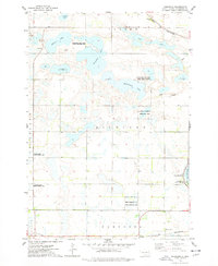
1969 Map of Pelican Lake
USGS Topo · Published 1971About this map
Pelican Lake and Clear Lake dominate this glacial prairie landscape on the border of Codington and Hamlin Counties. The topography is defined by numerous depressions and wetlands, such as the Five Ponds area, and a network of Gravel Pits that suggest local industrial activity during the late 1960s. The Burlington Northern railroad cuts diagonally across the terrain, passing through the small community of Foley. Settlement patterns are rural and dispersed, centered around local civic landmarks like the Townhall in the western portion of the map. For genealogists and local historians, the Oxford Cem located near the southern boundary provides a specific point of interest for tracing family roots within the townships of Pelican and Oxford. The inclusion of fine red dashed lines to indicate field boundaries and fence lines offers an unusually detailed look at the agricultural footprint of the era.
Find a feature on this map
15 named features on this map. Tap any name to fly to it.
Don’t see what you’re looking for? This feature index may not catch every label — zoom into the map to look around manually.
Map Details
Editions of this 1969 Pelican Lake Map
This is the sole edition of this map. No revisions or reprints were ever made.
Other maps of this area

1953 · Watertown
USGS Topo · 1:250,000

1958 · Watertown
USGS Topo · 1:250,000

1969 · Hayti
USGS Topo · 1:24,000

1969 · Castlewood
USGS Topo · 1:24,000

1969 · Watertown West
USGS Topo · 1:24,000

1969 · Watertown SE
USGS Topo · 1:24,000

1969 · Watertown East
USGS Topo · 1:24,000

1973 · Bryant NE
USGS Topo · 1:24,000
1973 · Kampeska
USGS Topo · 1:24,000
1973 · Grover
USGS Topo · 1:24,000